#raster data
Explore tagged Tumblr posts
Visit Tumblr Blog
Explore Tumblr blogs with no restrictions, modern design and the best experience.
Last Seen Tumblr Blogs


Fun Fact
70% of Tumblr users say the Dashboard is their favorite place to spend time online.
Photo

Spent entirely too long trying to find Canada’s version of MODIS, or really any free satellite raster imagery of British Columbia (because MODIS cuts out a lot of Vancouver Island), turns out I was looking in the wrong place. Now we’re really cooking here.
#the thesis saga#gis#raster data#wildfires#washington state#british columbia#satellite imagery#arcgis pro#back trajectories#firefly style#I got so extra about symbology that I downloaded a style specifically for this project because its pretty
2 notes
·
View notes
Text
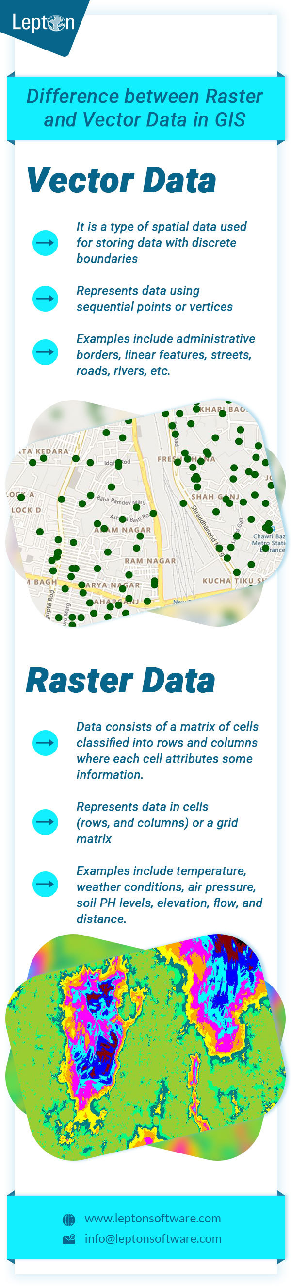
Raster vs Vector Data in GIS
Difference between Vector Data and Raster Data in GIS. Click to know more about best Desktop GIS Mapping Software.
0 notes
Link
Geographic Information System (GIS) is a computer-based tool or technology to manage, analyze and display geographically referenced information. Users can visualize, and understand the relationships between geodata in forms of reports, charts, maps etc. using GIS.
0 notes
Photo

CPLN 623- Global Urban Poverty
CPLN 600- Planning Workshop
CPLN 620- Techniques of Urban Economic Development
CPLN 680- Advanced topics in GIS (raster)
So excited and scared for next semester!!!
#cpln#city and regional planning#urban planning#gis#raster data#development#urban studies#urban development#economic development#2nd semester#penn#struggles
0 notes
Text
thank you, lackawanna county
i appreciate you having no up to date elevation data for out in farm country
0 notes